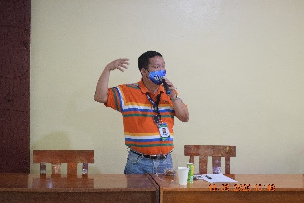
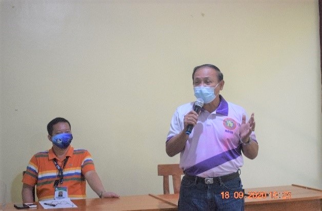
In its bid to gauge the mainstreaming of Gender and Development in the Department of Environment and Natural Resources - Region 1, the DENR– 1 conducted the Gender Mainstreaming Evaluation Framework(GMEF) workshop which aims to assess the efforts and to measure the extent of implementation of GAD in the agency.The organization’s GAD Focal Point System Chair Assistant Regional Director Leduina S. Co underscored the conscious implementation of the gender equality and urged the participants to do more work in making things happen and increase the awareness on gender sensitivity.
Vichel Rse E. Juguilon-Pangan, an Independent GAD Specialist from the National GAD Resource Pool explained that to be able to understand the GAD goals, a gender sensitivity activity must be initiated. Gender sensitivity aims to understand and take into consideration the societal and cultural factors involved in gender-based exclusion and discrimination in both the public and private life. She also emphasized that there is also a mind-gap in the role of women in the society. This started in the 19th Century that women are the ‘weaker sex’ and for a married woman as the ‘angel in the house’ and ‘just’a support to her husband. However, the dawn of the 20th century began to shape public views and understandings of women’s role in society now asserting their rights in nation building, thus the birth of activities for gender equality.
According to Ms. Pangan, this exercise on assessing the gender inclusion in the organization’s plan will remove the wrong notion on the role of women, as she pointed out that gender sensitivity also tries to ensure that people rely less on assumptions about traditional and outdated views on the role of men and women. Part of her lecture also include the use of gender fair language which must be observed in the organization.
A workshop was conducted to evaluate the scope and extent of the implementation of the GAD program focusing on the 4 entry points namely: policy, programs/activities/projects(paps), people and enabling mechanisms. (RAS-RPAO)
Mangatarem, Pangasinan - To boost and uplift the economic activity and tourism within the towns along the Daang Kalikasan (Nature Road) linking the provinces of Pangasinan and Zambales, a stakeholders consultative meeting spearheaded by the Department of Environment and Natural Resources, Region- I (DENR- I) was held at the Manleluag Spring Protected Landscape (MSPL), Mangatarem, Pangasinan last September 18 ,2020. The stakeholders’ consultative meeting is to conceptualize the Master Plan for the DaangKalikasan Developmental Framework in the region I portion, an environmental vision and pet project of then Pangasinan 2nd Disrtrict congressman and now Lingayen, Pangasinan Mayor Leopoldo Bataoil.
The scenic Daang Kalikasan road is a 54- kilometer stretch old abandoned logging road used by illegal loggers widened and improved, of which the construction of the Mangatarem, Pangasinan side started in 2017 linking Sta. Cruz, Zambales which was later spruced up to provide the fastest and directly linking the provinces of Pangasinan and Zambales winding road over the breath taking crest of hills and pristine mountains. The proposed development area of Daang Kalikasan is 19 kilometers covering the jurisdiction of Region- I, which was initially initiated in 2012 by then Pangasinan 2nd District Rep. Bataoil. The road has a width of concreted 20 meters from the road center line and another 10 meters is reserved as a “No Build Zone” area. However, even in its partially reopened state and already drawing tourists, is expected to spur more economic activity and tourism in the two provinces. This will also enhance environmental resuscitation, tourist attraction and people will indulged in authorized livelihood activities and corridor for economic activities. This road linking the two provinces will hasten not only travel but also trade and tourism since it passes through mountains and its construction will also ensure the protection and preservation of the remaining forest cover in the area.
Present during the consultative meeting were DENR- I key officials headed by Atty. Crizaldy M. Barcelo, and DENR- I field offices, representatives from Environmental Management Bureau, Region- I (EMB- I) and Mines and Geosciences Bureau, Region- I (MGB- I), the main proponent of the Daang Kalikasan, Municipal Mayor of Lingayen, Pangasinan Leopoldo Bataoil, Congressman Jumel Espino of the 2nd District of Pangasinan, representatives from Department of Public Works and Highways (DPWH), representatives from the Office of Presidential Adviser for Northern Luzon, and concurrent Cagayan Economic Zone Authority (CEZA), Secretary Raul Lambino, people’s organization, local government units (LGUs) and among others.
The Daang Kalikasan Master Plan was initially presented by RED Barcelo to Secretary Lambino during the latter’s visit in San Quintin, Pangasinan last September 4, 2020 of which he lauded the “DENR- Ilocos Region leadership for being proactive in advancing development.” RED Barcelo emphasized during the meeting that “DENR- I is apolitical and simply delivering public service to the people for the good of the environment and all are duly represented by different government line agencies who are involved in the development initiative of the Daang Kalikasan within the jurisdiction of the municipality of Mangatarem.” RED Barcelo stressed that there will be first a Master Development Plan, Geohazard Assessment and Vulnerability Risk Assessment of the area after which all principal stakeholders will ink a derivative memorandum of agreement in order to implement the developmental initiatives. Congressman Jumel Espino of the 2nd District of Pangasinan was also present to give his full support to the Daang Kalikasan initiatives stressing the eco- tourism impact to the province of Pangasinan which will create additional funds.
DENR- I ARD for Special Concerns and representing the Mines and Geosciences Bureau (MGB) –Region- I, Engr. Socrates Gaerlan presented the Geohazard Mapping and Hydrological Survey along Daang Kalikasan area of which only 10 kilometers was then accessible for survey mapping. The MGB mapping and surveys is needed for the developmental purposes and environmental hazards of the area particularly on the susceptibility to erosion. The planned 20 meters road for development include the beaches and the canals, parallel to it the 10 metersin both sides of the road which is the “No Build Zone” that belongs to the DPWH, as additional area for protection.
For planning purposes, the proposed Daang Kalikasan development was presented and discussed in details by DENR- I Conservation and Development Division (CDD) Chief Barbara Pernia by segment. Segment No. 1 is a 3 -kms. portion that indicate plant able for buenavistaand ilang-ilang and other flowering plants. The entry point of the 3km. portion of the road is the “Information Center or Pasalubong Center” structure along with People’s Organization (PO) bunk house and these POs will assist the DENR in managing the Information Center. Segment No.2 is a long 2-kms. stretch suitable for planting and replanting tree species, a manned ranger station with firefighting equipment, view deck, a long Small Water Impounding System (SWIS) is also needed in this area because the water source will be used for the planting Bougainvillea which are beautiful during summer and required less maintenance and Acacia Mangium because of the soil condition is suitable including hardwood species. Segment No. 3 is a 3-kms. stretch and an area planned for the establishment of a model nursery, a visitor’s center, kiosks while Sunflower plants and Agoho tree species and there are remnants of Pine trees in this area. The Segment No. 4 – is the 4-kms. end of the 10- km. road and a part of the area has been awarded to CS First Green Agri- Industrial Devt. Inc.as Integrated Forest Management Agreement (IFMA) purposely for bamboo production. A proposed bird watch tower is suited in this area since Mangatarem is also listed as International Birdwatch Area (IBA). Santan is also suitable and be planted in the No Build Zone area including Eucalyptus species then eventually Pyrograph planting.
The Municipality of Mangatarem has an existing approved Forest Land Use Plan (FLUP) and an active steering committee thus, the FLUP should be updated to incorporate whatever development plans that DENR- I and other agencies have proposed in the Daang Kalikasan area. Government line agencies like the Department of Tourism (DOT), Department of Transportation and Communication (DOTC), Department of Public Works and Highways (DPWH), Department of Science and Technology (DOST), National Economic and Development Authority (NEDA), LGU- Mangatarem, non- government organizations (NGOs) and DENR- I involved in the Daang Kalikasan development will have their respective roles in advancing eco- tourism and mobile communications in the area. So the vital structures and radar stations maybe allowed subject to permits while DENR- I on its part is designated to take care of the 40 meters ‘development zone” and it will adopt a portion as its model segment. Power convergence was also defined, ideally, converge together between two or three entities that will integrate their platform that will result to optimal benefits and through a MOA, contributions will be defined in terms of shared resources or activities that will have to be contributed in a certain area. The involvement of road users’ fee or probably “environmental fee” will be used to generate funds was also suggested.
The Daang Kalikasan area is also suitable site for social mobilization, to raise advocacies and awareness campaign for environmental protection and conservation. There is also a plan to adopt a segment as National Greening Program (NGP) site with corresponding guidelines from the DENR of which the agency also wanted to maintain the environmental sanitation in the long stretch of the road. As conclusion of the presentation, CDD chief Pernia showed a prepared rough Work and Financial Plan as sample indicating the cost estimates, infrastructure and vegetative measures and the contribution of each stakeholder is identified.
In his closing statement, RED Barcelo said “Daang Kalikasan will be a model development project to be replicated in other areas” as instructed to him by DENR Secretary Roy Cimatu. The DENR led by Secretary Cimatu made the impossible rehabilitation of the famous Boracay Island and the latest is the Manila Bay enhanced by introducing the Dolomite bringing life and nature closer to the Manilenos. Manila Bay is the “show window” of the Philippines to the world. Green Infrastructure Combined with Development just like the Daang Kalikasan, is possible and can be realize with the collective efforts of all stakeholders. RED Barcelo stated, “We in the DENR cannot do it alone, we need your help, cooperation and intervention from all stakeholders, the government and private sectors, LGUs to finalize this plan.” Without any doubt, our collective and collaborative efforts will reap a fruitful harvest. (RPAO)
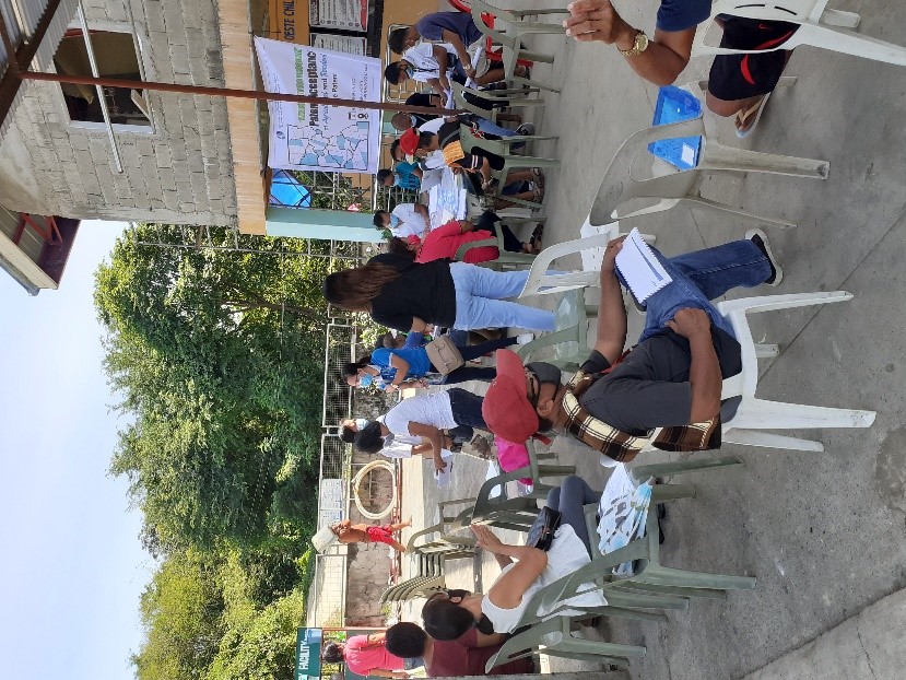
SAN FERNANDO CITY, La Union- In line with the celebration of 119th Anniversary of the Land Management Bureau or Lands Day of the Department of Environment and Natural Resources (DENR), DENR- Region- I headed by Regional Executive Director Atty. Crizaldy M. Barcelo through the Licenses Deeds and Patent Division (LPDD) in collaboration with the Provincial Environment and Natural Resources Office (PENRO) La Union together with the Barangay Council of Dallangayan Oeste, San Fernando City, La Union led by Barangay Captain Gavino Martinez Jr., conducted Agricultural and Residential Free Patent Application for Barangay Dallangay Oeste residents and other adjoining barangays on September 3- 4, 2020.
The said activity is in line with the previously conducted Information Drive relative to the “Handog TituloProgram” of the DENR last August 25, 2020 and Barangay Dallangayan Oeste was chosen to be the venue on said very significant activity. DENR- I and PENRO La Union land investigators interviewed land title and non- title holders and assessed pertinent documents. The Handog Titulo Program is one of the initiatives DENR to boost the government’s public service on land distribution program. Under the Rapid Land Tenure Appraisal (RLTA), land titling processing will be fast-track. RLTA is an appraisal program under the Land Management Bureau designed to systematically assess and profile a specific area in terms of land status of subdivision, ownership and other relevant indicators that might be needed in the near future. This program aims to give actual and exact figure of how many lots are workable for titling and number of titled lots. Likewise, the program is one of the approaches to accelerate land titling.
The Residential and Agricultural Free Patent will conclude on December 31, 2020. For more details, visit or contact the nearest CENRO/ PENRO offices, DENR- I Regional Public Affairs Office (RPAO) Government Center, Sevilla, San Fernando City, La Union with Tel. No. 700- 00-10 or DENR- Ilocos Region Facebook Page for more details. ###
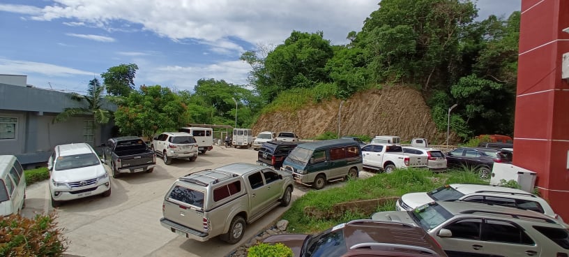
San Fernando City, La Union – Two major infrastructure projects in partnership with the Department of Public Works and Highways, Region- I (DPWH- I) and the Department of Environment and Natural Resources, Region- I (DENR- I) has gone a long way with the recent construction of two projects office located in Government Center, Sevilla, San Fernando City, La Union was finally completed this year.
Upon the request of then DENR- I Regional Executive Director Reynulfo A. Juan in 2018, DPWH- I approved and funded the construction of DENR- I Concrete Paved Parking Area amounting to P 1.1- million which is located in the northwest portion premises of the DENR- I Regional Office. The DENR- I Parking Area aims for the orderly handling and safekeeping of the agency’s service vehicles, clientele and employees vehicles as well.
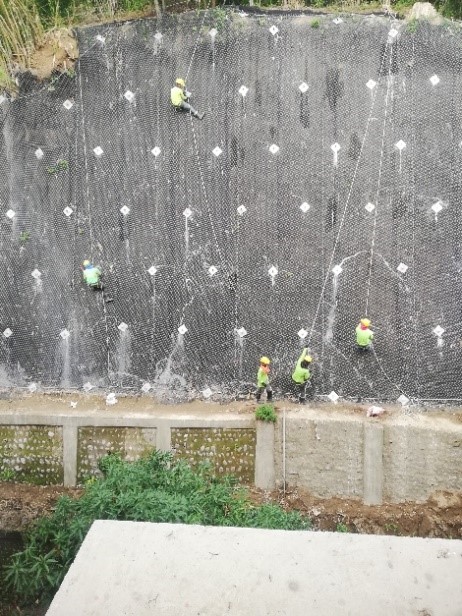
Another DPWH- funded infrastructure project which was requested by DENR- I Regional Executive Director Atty. Crizaldy M. Barcelo last February, 2020 and was immediately approved by the DPWH- I is the construction of the P 17.1- million Active Slope Protection Project (Riprap) located at the hilly rear portion of the DENR- I Office premises. The project aims to prevent the heavy rain impact run- off velocity of the road and soil erosion to DENR- I grounds and other government offices in the Government Center. The program of works and the construction plan was prepared by the DPWH in response to the DENR- I request for technical assistance. The construction of the project was officially completed in August 28, 2020.
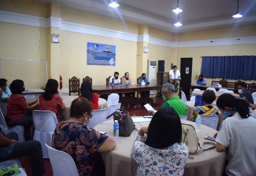
VIGAN CITY, Ilocos Sur– The Department of Environment and Natural Resources (DENR) Region I, headed by Regional Executive Director, Atty. Crizaldy M. Barcelo, and the Provincial Government of Ilocos Sur, led by Gov. Ryan Luis V. Singson, signed the Memorandum of Partnership Agreement (MOPA) for the implementation of the Provincial Foreshore Development and Management Plan (PFDMP) at the Provincial Capitol, Vigan City, Ilocos Sur on September 22, 2020. The event was likewise, attended by , Vice-Governor Jeremias “Jerry” C. Singson, Sangguniang Panlalawigan Member and chairman committee on environment, Christopher Baterina, Vigan City Mayor Carlo S. Medina, Sta. Cruz Mayor Teresita Valle, Sta. Lucia Mayor Joseph Simon Valdez, and San Esteban Mayor Ray Elaydo II.
The FDMP, first piloted in Ilocos Sur and Ilocos Norte, is a long-term, collaborative strategy between and the DENR, the LGU of Ilocos Sur and other stakeholders in the improvement, development, management, protection, and conservation of natural resources within the foreshore areas. It is also one approach in combating underlying threats, issues, and concerns within the 18 coastal municipalities of Ilocos Sur.
“The Ilocos Sur FDMP requires a multi-sectoral approach by which Local Government Units (LGUs) within foreshore areas, the Provincial Government of Ilocos Sur (PGIS), Department of Tourism (DOT), Department of Public Works and Highways (DPWH), National Economic and Development Authority (NEDA), Bureau of Fisheries and Aquatic Resources (BFAR), Philippine Ports Authority (PPA), Philippine Coast Guard (PCG), University of Northern Philippines (UNP), Environmental Management Bureau (EMB), and Mines and Geo-Sciences Bureau (MGB) actively participated and assisted during its formulation activities”, said RED Barcelo.
Further, Ilocos Sur Provincial Environment and Natural Resources Officer, Rosemarie B. Jornacion mentioned that a number of concerns and issues were revealed during the ground validation along the foreshore areas of Ilocos Sur that needs to be addressed. Some of these were soil/sand erosion, flooding, tsunami, improper waste disposal, and the like. The plan, “will provide strategic directions to address predicaments and unsustainable impacts on the area and community.” she added.
Congruent to the said agreement, the DENR with PGIS and other National Government Agencies (NGAs) pledged to work to fulfill the PFDMP vision: “A progressive and sustainable foreshore area of a world-class heritage province that promotes eco-tourism and socio-economic development, managed by God-fearing and empowered citizens guided by principle-centered leaders, to provide equal benefits for the present and future generation.”
The plan, as RED Barcelo mentioned, will draw a guiding framework on the best management scheme to be adopted in a specific environment, particularly on the identification of the highest and best use whether it is legally permissible, ecologically viable, economically valuable, socially acceptable and/or compatible with adjacent land uses of a particular area. It will be implemented for the next 10 years along the 158 kilometer foreshore stretch of Ilocos Sur.
“The Province of Ilocos Sur is one of a kind for it has mountains and forests that nears the coastal and beaches. Nature lover tourists were so fond to visit our place since it is a 2-in-1 package adventure. Thus, keeping our coastal areas clean is a must”, he said.
As response, Gov. Ryan Luis V, Singson commended DENR for the implementation of different projects and activities that promotes ENR protection and conservation especially within the Province of Ilocos Sur. It was assured that the provincial government’s support in the programs and continued partnership in conserving the environment. “Local Government Units shall continue to work together with the DENR for the betterment of our nature,” Gov. Singson added.
RED Barcelo, at the end of the MOPA signing, assured that the management initiatives and activities defined in the plan will be carried out this year. Moreover, he is hopeful that the DENR and its stakeholders will continue to work hand in hand for the successful implementation of the said plan.


 ities for gender equality.